October 23, 2007
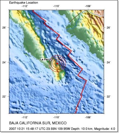
The United States Geological Survey site (USGS, http://earthquake.usgs.gov/) reports that on Sunday 10/21/2007, a magnitude 4.0 earthquake hit Baja California Sur, 44 km (28 miles) south of La Paz.
Earthquake Center » Latest Earthquakes - World »
Magnitude 4.0 - BAJA CALIFORNIA SUR, MEXICO
- Click here for more information on this earthquake.
- Click here for maps of this earthquake.
- Click here to view the earthquake location in Google Maps, where you can zoom in and out, pan, and see how far is Loreto. The exact location of the earthquake was at +23° 55' 44.40", -109° 57' 3.60" (23.929°N, 109.951°W).
I haven't heard any reports of injuries or damage to property from our friends in Loreto and Todos Santos - everything seems ok.
When Janelle and I started working on the architectural designs for our house, we worried about Mexican construction standards, at least in relation to California earthquake construction standards.
But as we learned more about the process, we now feel that a 6 foot deep foundation and the rebar and concrete structures seem to handle such earth shaking events pretty well.
I don't know what would happen if a major 6.0 or higher earthquake hit Baja, but I've heard of a few 4.0 and lower earthquakes that have occurred in the past, and as far as I know, so far Baja buildings and houses have had no problems.