April 9, 2011
Janelle and first stumbled to what is today Loreto Bay in 2002, when we drove from San Francisco all the way down to Cabos San Lucas and Todos Santos at the southern tip of Baja California Sur (BCS).
At the time we literally stumbled upon the “Camino Real” hotel (what is today the “Inn at Loreto Bay”) – we were asking for directions to a hotel or restaurant and the parking attendant at the “Camino Real” told us “we’re a hotel/restaurant – we just opened!”.
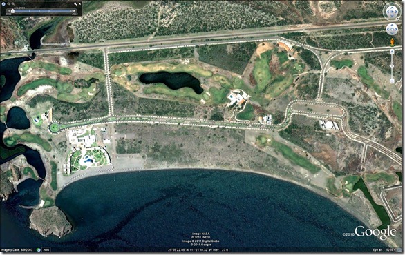
Google Earth has a cool feature that allows you to travel through time and see historical satellite images of the same location. Here’s what is today Loreto Bay, back in August 2003, just like we first remember it, with only the hotel and a few houses around Nopolo -

Loreto Bay, August 2003, click on image to enlarge
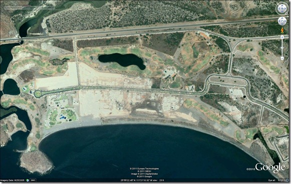
Here’s the next available satellite image from June 2005, where we can see some progress in Loreto Bay’s “Founder’s Neighborhood” -

Loreto Bay, June 2005, click on image to enlarge
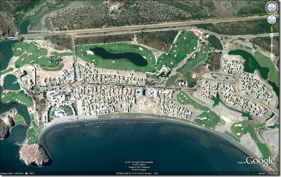
Finally, here’s the latest satellite image from January 2010 -

Loreto Bay, January 2010, click on image to enlarge
Not only is the "Founder’s Neighborhood” done, but a large part of Loreto Bay’s second neighborhood, “Agua Viva” is also pretty well built.
Try it out for yourself - to download Google Earth, point your browser to http://earth.google.com – it’s free. To enable in Google Earth 6.0 and above click on View > Historical Imagery – if historical satellite images are available you’ll see a slider in the top left to control the year/image.